The San Gabriel Mountains rise sharply just north of Rancho Cucamonga, feeding the alluvial fans that underlie most of the city. These fans create a subsurface puzzle: interbedded sands, silts, and gravels that can amplify ground motion in ways a generic code map misses. A seismic microzonation study resolves that puzzle by mapping how site-specific soil profiles, depth to bedrock, and basin-edge effects alter shaking intensity across a property. In Rancho Cucamonga, where the Sierra Madre fault zone runs nearby, this level of detail shifts the conversation from minimum-code compliance to actual risk management. The work draws on CPT logs, shear-wave velocity profiling, and boring data to build ground response models keyed to NEHRP site classes and ASCE 7 Chapter 20 requirements.
A site at the base of the alluvial fan can experience shaking two to three times stronger than a rock site two miles south, even for the same earthquake.
Scope of work
Area-specific notes
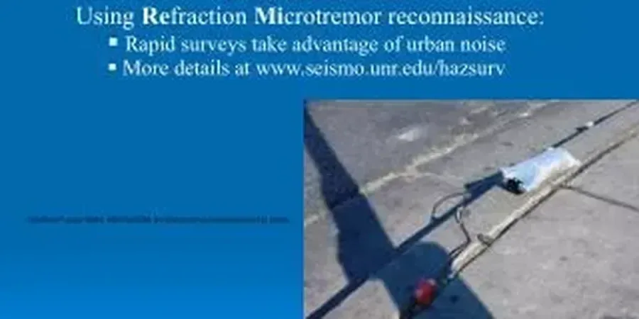
A trailer-mounted triaxial geophone array moves across the site in a grid pattern, recording surface waves generated by a sledgehammer source. In Rancho Cucamonga, the dry summer months compact the upper crust of the soil, which can artificially stiffen the top three meters and bias a MASW inversion toward higher Vs30 values. The geophysicist compensates by running longer receiver spreads that sample deeper energy and by comparing forward-modeled dispersion curves against the field data iteratively. Skipping this correction yields a site class C where a class D is actually present, and that difference drives the structural lateral loads up or down by 30 percent or more. The field crew also documents nearby concrete-lined channels and buried utilities, since those features act as waveguide reflectors that contaminate the velocity spectrum if not filtered during processing.
Standards used
ASCE 7-22 Chapter 20 (Site Classification Procedure), IBC 2024 Section 1613 (Earthquake Loads), ASTM D4428/D4428M-14 (Crosshole Seismic Testing), NEHRP Recommended Provisions (Site Coefficients), California Building Code Chapter 16A
Linked services
Shear-Wave Velocity Profiling
MASW and downhole surveys to measure Vs30 and map lateral velocity changes. We cross-check results against available boring logs to ensure the geophysical model honors the known stratigraphy.
Site Response Analysis
One-dimensional equivalent-linear modeling using DEEPSOIL or SHAKE2000. Input motions are scaled to the site-specific hazard spectrum from the USGS Unified Hazard Tool, and the analysis accounts for the basin-edge effect near the San Gabriel foothills.
Microzonation Maps and Design Spectra
GIS-based deliverables showing site class boundaries, amplification factor contours, and uniform-hazard response spectra. The structural engineer uses these directly to compute seismic base shear per ASCE 7.
Typical parameters
Common questions
What is the typical cost range for a seismic microzonation study in Rancho Cucamonga?
For most commercial or residential subdivision sites in Rancho Cucamonga, the study cost ranges from US$4,610 to US$17,560, depending on the number of MASW lines, depth of investigation, and whether laboratory dynamic testing is included. A small pad site with two geophysical lines costs less than a multi-block development requiring a dense grid and site response modeling.
How does microzonation differ from the site class shown on the USGS map?
The USGS National Seismic Hazard Map assigns a site class based on regional geology, often at a 1 km grid spacing. A microzonation study measures actual Vs30 at multiple points on your property. In Rancho Cucamonga, where alluvial fan deposits can change from gravel to silt over a few hundred feet, the USGS proxy may classify the entire area as site class C while the measured data reveals a class D pocket that amplifies short-period shaking more than the code default assumes.
Does the City of Rancho Cucamonga require a site-specific ground motion analysis?
The City defers to the California Building Code. Under CBC Section 1613 and ASCE 7-22 Section 11.4.8, a site-specific analysis is required when the structure is classified as Risk Category III or IV and the site is within 10 km of an active fault, or when the site class is F (liquefiable soils, peats, high-plasticity clays). Several areas of Rancho Cucamonga meet these triggers, particularly near the Sierra Madre fault trace and in the Day Creek basin. More info.